Outdoor Activities
Glenmulliach Viewpoint (Walk 1)
5.5km/3.5 miles Allow 2 hours
It is unlikely that Livestock will be encountered on this walk
Start -
Glenmulliach Forest car park (Nr Tomintoul): NJ 193 168 - Follow Green Arrow Waymarkers with Dragonfly Logo.
From the car park follow the forest road with the Allt a Mulliach burn running alongside, passing a gateway and keeping left (straight ahead) at the junction. The track continues gradually climbing uphill through forestry, cleared following gales in 1989. These areas were re-planted with a mix of conifers and broadleaves, which has created a more diverse and attractive woodland. Just beyond the junction on this track you will find the ruined Glenmullie farmstead, a sign of past times when this land was high pasture, before afforestation.
Back on the main track continue uphill through the stands of Spruce and Scot’s Pine. Look out for wrens flitting amongst the brash and woodland edges, and red squirrels, siskins, redpoll and crossbills active in the treetops above. The track emerges from the woods near a small deep reservoir, an emergency water source for helicopters fighting forest fires. Continue through a gate and across moorland to a junction where you turn right and head towards the communications mast. The route takes you up the gentle slope of Breac Leathad, where you are surrounded by heather moorland. Keep an eye out for mountain hares (in their white coats in winter) and red grouse taking flight.
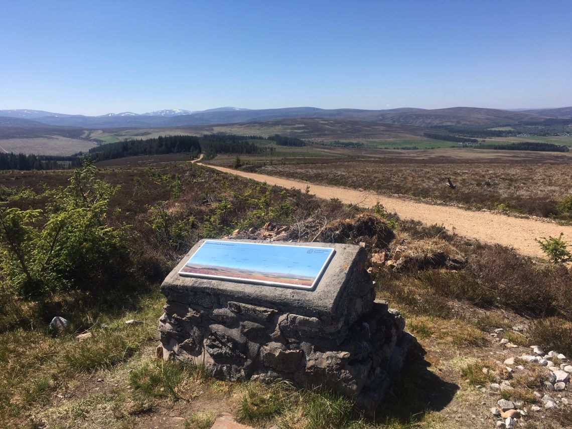
The turn around point of the walk is before the mast at a viewpoint, marked by a stone plinth with a viewpoint indicator, on the right. Here panoramic views of the high tops of the Eastern Cairngorms and across the estate to Tomintoul can be enjoyed on a clear day. Next to the viewpoint look out for the tree stumps visible in the peat, the only reminder of the ancient Caledonian pine forest that once grew here some 3000 years ago. Work is currently being undertaken to restore the area of peatland bringing benefits for biodiversity and carbon storage.
The trail returns the same way to the forest edge at the fire pond, just beyond this turn left through a high deer fence to follow a circular loop. Ahead of you sweeping views of the Cairngorm range open up, with a different aspect as you turn each corner. To the right there is a clearfell area with scattered standing dead trees, purposely left due to their value for wildlife and as perches for birds of prey, such as the commonly seen buzzard, who use the vantage points to spot prey below. As you descend you pass through another deer gate and follow around a bend, before turning right onto an adjoining track and continue descending to the next junction. Here turn left and you are back on the original track to the car park. Before leaving take a moment to discover the Glenmulliach ponds, situated adjacent to the car park picnic area and the nearby Conglass water. A nature trail also starts from the car park, exploring the lower corner of the woods.