Outdoor Activities
Scalan Heritage Trail (Walk 2)
4.5km/2.8 miles Allow 1 hr30
It is likely that both sheep and cattle will be encountered on this walk – please follow the Scottish Outdoor Access Code. Also check field before entering and detour to avoid cattle if necessary. Keep dogs on a lead or under close control and if threatened by cattle release your dog.
Start
Carrachs Car Park nr Chapeltown, Braes of Glenlivet NJ243201 – Follow Orange Arrow Waymarkers with Watermill logo.
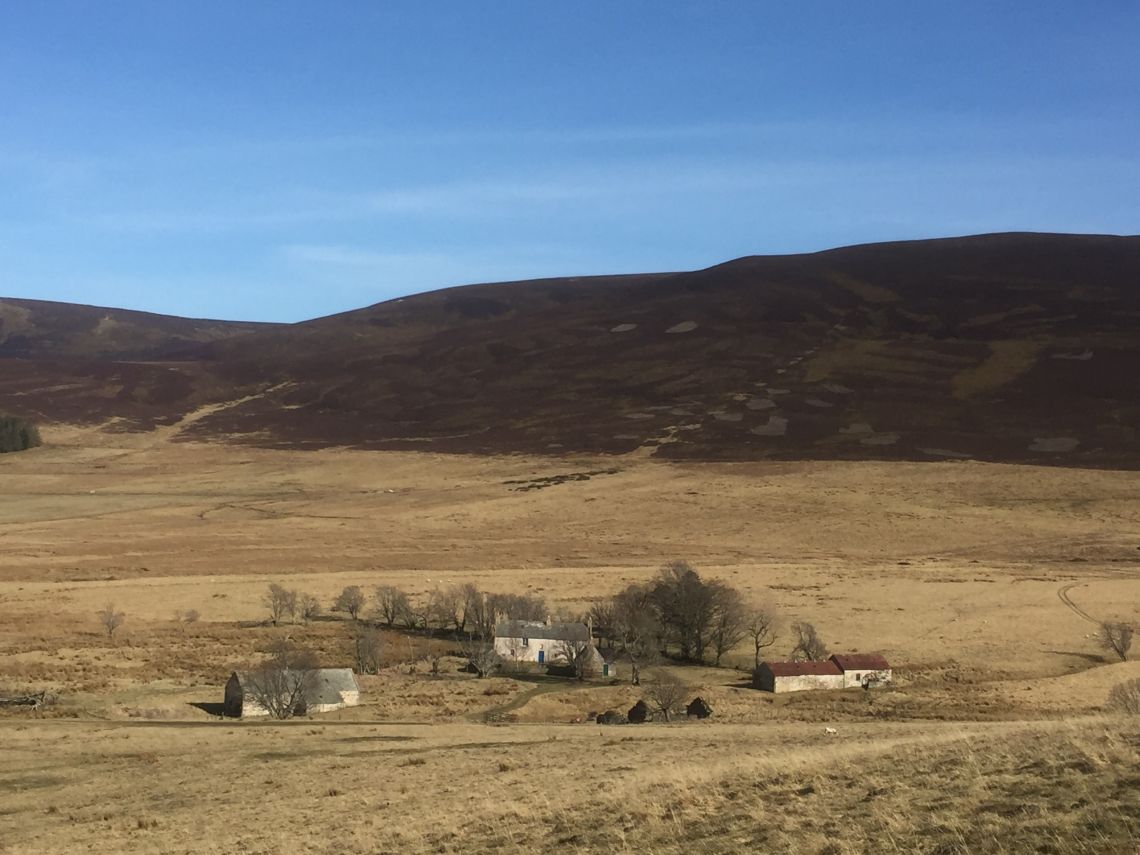
Follow the track from the car park, before passing through a gate and heading across a grassy track over open land reaching the old College of Scalan after about 1km. The secluded building of Scalan (from the Gaelic sgalan, meaning turf roof) was once a seminary (a college for training priests) and was one of the few places in Scotland where the Catholic faith was kept alive during the troubled times of the 18th century. The Scalan Seminary is open all year for visitors to savour how “with courage and dogged perseverance” the Catholic faith survived and a detour to explore the building is thoroughly recommended. The associated Mill buildings are only open on certain occasions and if you wish to see them contact the Scalan Association or Tomintoul and Glenlivet Development Trust.
Leaving the Scalan’s fenced enclosure take the grassy track to the left which heads southwards towards the hills. The path deviates slightly from the track at the ford, crossing instead over a boardwalk. Rejoin the track and follow it along the Crombie water to the remote ruins of the Clash of Scalan (from the Gaelic clais, meaning furrow, narrow, shallow valley). Turn westwards (to your right) amongst the ruins and follow the path across a ford over the Crombie water. You then head uphill following an old stone dyke which peters out just below a fence. Oystercatcher, curlew and lapwing are commonly seen in this area, nesting in the springtime and later in the summer gathering in large flocks before flying back to the coast for the winter. Cross the fence at the stile and pause to admire the views. To the north beyond the distillery is the rounded shape of the Bochel, an isolated hill at the head of the Braes of Glenlivet, while eastwards the Ladder hills stretch into the distance towards the expansive bowl of the Suie.
From the stile a diversion can be made to the summit of Tom Trumper by heading uphill along a line of grouse butts. A cairn lies just below the actual top and it is worth continuing a little further on to enjoy the views westwards to the Cairngorms. This section of path may not be accessible when shooting is in progress during the grouse season (Aug-Dec).
Continue from the stile downhill alongside the fence, before rejoining the original track near the first gate. Turn left and return along the track to the car park. At the car park it is worth enjoying the short walk around the Carrachs Ponds. These ponds were created in 2010 to mark International Year of Biodiversity, and have provided a new wetland habitat that benefits a wide range of creatures.