Outdoor Activities
The Livet Path (Walk 3)
9.5km/6miles Allow 3-4 hours
It is likely that both sheep and cattle will be encountered on this walk – please follow the Scottish Outdoor Access Code. Also check field before entering and detour to avoid cattle if necessary. Keep dogs on a lead or under close control and if threatened by cattle release your dog.
Start -
Allanreid car park (Nr Tomnavoulin): NJ 236 248 - Following blue arrow waymarkers with Eagle logo in the centre.
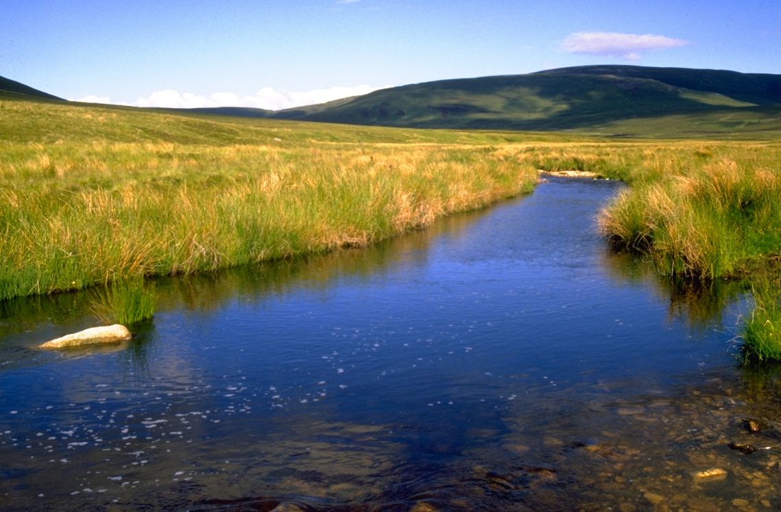
From Allanreid car park turn right, cross the road bridge and continue past a memorial cairn onto the farm track. After a short distance, take the right hand fork and head towards the footbridge over the River Livet (from the Gaelic – liobh ait meaning ‘smooth flowing one’). Do not cross the bridge, but turn left and stay on the north bank of the river, following the track. The trail leaves the river passing through trees, before emerging into a field. Keep on the rough track following the fence line through the field before crossing a boardwalk over a small ford and rejoining the River Livet at the footbridge near Inverblye. Cross the bridge and follow the track through a gate.
Continue along the well defined track on the south bank of the Livet for about 1.5km until the path meets another gate. This section alongside the river, through fairly remote and exposed in bad weather is one of the most enjoyable on the estate. Turn right at the pedestrian gate leaving the main track. (The main track continues eastwards to the Suie and the rights-of-way which continue through the Blackwater Forest to Cabrach and through Glen Suie to Glenfiddich).
The walk now passes through expansive moorland – for a long time the hunting grounds of the Duke of Richmond and Gordon. It is here, on the lower slopes at the northern end of the Ladder Hills, that you can occasionally pick out the distant shapes of red deer browsing amongst the heather. Follow the fence southwards, away from the river for about 300m before turning right onto a track (adjacent to another gate). Follow the track (which at first is fairly indistinct in places) westwards through the heather. The track soon becomes more obvious and crosses the open moor to reach the Blye water and the scattered buildings of the Burnside of Thain. There are lovely views onto the prominent hill of the Bochel and the Braes of Glenlivet. N.B. This section of path across the moor may not be accessible when shooting is in progress during the grouse season.
At the Blye water continue across the burn and along the farm track to a junction of tracks above Rhindhu. At this point a detour can be taken by turning left (south) and following the track and road to Chapeltown and the Scalan (see page 8). From the junction continue straight ahead into a field and along the track before turning sharp right staying alongside the fence line. Continue along the farm track past the cottages of Eskemore and Badievochel, heading towards the Bochel.
At the next junction of gates and tracks, continue ahead (northwards) staying to the topside of the fence, away from the track running parallel to the right. Follow the sheep walks which skirt the base of the Bochel, picking a path carefully across the sometimes boggy ground. At the northern side of the hill above the Glack cottage, turn right through the field gate and head downhill through the field to join the track from the cottage. Continue along the track, crossing over the Livet footbridge and rejoin the starting route near Allanreid.